What to Expect of Hawaii’s Climate
One of the wonders of Hawaii is its remarkably delightful and stable weather. It is the only one of the 50 states that is both in the tropics and surrounded by the ocean. This, together with the topographic diversity of the individual islands, are what create Hawaii’s magnificent climate.
“Mostly Sunny” vs. “Party Cloudy”
Interestingly, Hawaii’s two most frequent forecasts are either “Mostly Sunny” or “Partly Cloudy.” How the weatherman differentiates between the two is a mystery to most, but rest assured that the weather here is nothing if not moderate.
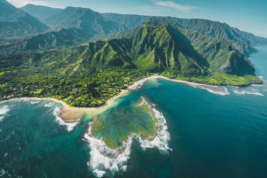
Each of the islands of Hawaii can be thought of as a “mini-continents,” where on each island you find desert, tropical rainforest, temperate, and tundra climates. Hawaii has the longest coastline in the USA, yet is quite mountainous. Fifty percent of the state has an elevation of 2,000 feet and 10 percent is over 7,000 feet. Kauai’s highest point is 5,240 feet, Maui’s is 10,023 feet, and Hawaii’s (the Big Island) highest elevation is a towering 13,796 feet. The combination of so much coastal area and mountains results in diverse climatic conditions, especially on Hawaii and Maui.
Each of the Hawaiian Islands can be divided into seven climatic sub-regions:
1. Windward (toward the wind) Lowlands are generally below 2,000 feet on the north to northeast sides of the islands. This region lies more or less perpendicular to the prevailing flow of the trade winds, and is moderately rainy, with frequent trade wind showers. Partly cloudy to cloudy days are common and temperatures are more uniform and mild than in other regions.
2. Leeward (away from the winds) Lowlands have daytime temperatures that are slightly higher and nighttime temperatures that are slightly lower than in windward locations. Dry weather prevails except for occasional light-trade wind showers.
3. Interior Lowlands, on Oahu and Maui can have the characteristics of both the windward and leeward lowlands. The central areas, especially on Oahu sometimes experience intense local afternoon showers as a result of local heating of the land during the day.
4. The Kona Coast of Hawaii (The Big Island) is the only region in the islands where summer rainfall exceeds winter rainfall. Land and sea breezes prevail, especially in the summer. Summer is also the season of many late afternoons or early evening showers. Here conditions are warmer and drier than on the windward side.
5. Rainy Mountain Slopes on the Leeward Side has lots of rainfall and cloudiness in both winter and summer, as well as higher humidity.
6. Lower Mountain Slopes on the Leeward Side has more rainfall than the leeward lowlands, but less than the windward side at the same level.
7. High Mountains–At 2,000 or 3,000 feet on the mountains of Mauna Kea, Mauna Loa, and Haleakala, rainfall decreases rapidly the higher you go. Near the summits of Mauna Loa and Mauna Kea, skies are clear nearly all the time, and humidity is very low. The lowest temperatures in the state are recorded on these peaks and are often below freezing.
 Hawaii features persistent trade winds in a general east-to-west direction. The heart of the trade winds flow across Hawaii during the period May through September, when the trades are prevalent 80 to 95 percent of the time. From October through April, the heart of the trade winds blow south of Hawaii and are prevalent 50 to 80 percent of the time.
Showers are very common and sometimes quite heavy, but the vast majority are light and brief–just a sudden sprinkle of rain. Thunder and lightning are very rare. The trade winds provide refreshing natural ventilation much of the time throughout most of the state.
There is only a slight variation in the length of night and day from one part of Hawaii to another since the major islands of the state all lie within a narrow latitude band. The relatively slight variations in the length of daylight in Hawaii and the smaller annual variations in the altitude of the sun above the horizon result in relatively small variations in the amount of incoming solar energy from one time of the year to another. This, combined with the constant flow of fresh ocean air across the islands is the reason for Hawaii’s minimal seasonal temperature changes.
The native Hawaiians recognized only two seasons. KAU (May through October) was the fruitful season, the season when the sun was directly or almost directly overhead, the weather was warmer, and the trade winds were most reliable. HOO-ILO (November through April) was the season when the sun was in the south, the weather was cooler, and the trade winds were most often interrupted by other winds.
Variations in rainfall on the Hawaiian islands are dramatic. At one extreme (the west side of the Big Island), the annual rainfall averages 20 inches. There is also very little rain at the summits of the Big Island’s Mauna Loa and Mauna Kea. At the other extreme, the annual average exceeds 300 inches along the lower windward slopes of these high mountains, Haleakala (Maui), and at the summit of the lower mountains of Kauai, Oahu, and western Maui. But the winner of the title of “Wettest Spot on Earth” goes to Mt. Waialeale in the deep interior center of Kauai, where the average annual rainfall is an incredible 486 inches (over 40 feet). The average annual rainfall over the entire state is equivalent to 8,000 billion gallons of water! Luckily the place where you’ll be visiting will probably have just the right amount of rain to make it lush and gorgeous. One of the nifty things about Hawaii is that due to the complex rainfall patterns, it possible to be standing in the sun and see it raining ten feet away from you.
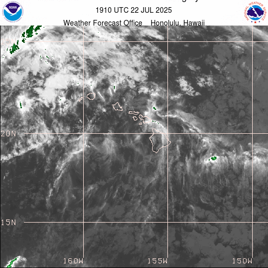
Hawaii Tsunami Creates Pacific Tsunami Warning System
Following the Hawaii tsunami of 1946 that struck Hilo on the Big Island, a tsunami warning system for the Pacific basin was developed by the U.S. Coast and Geodetic Survey. Presently, the Pacific Tsunami Warning System, which has its headquarters in Honolulu, is administered by the National Weather Service under the National Oceanic and Atmospheric Administration (NOAA). The Tsunami Warning Center receives a constant flow of information from seismometers (instruments that detect earthquakes) and tide-gauge stations all around the Pacific Ocean.
When an earthquake with the potential to generate a tsunami occurs, the Warning Center puts out a “tsunami watch” within 30-40 minutes, alerting Civil Defense and other authorities of a possible tsunami. The first positive evidence of a tsunami comes from tide stations near the origin of the earthquake. Once the presence of a wave is confirmed, the Honolulu center issues a “tsunami warning,” giving an estimated time of arrival for the first wave. When a warning is issued, local authorities evacuate low-lying coastal areas. The system’s sirens along the coasts of each island are tested “live” on the first state workday of every month at 11:45 am.
Average Temperatures
The differences in temperature, as you would imagine, are the result of variations in elevation. In the mountains in the summer daytime temperatures are in the 60s and nighttime temperatures are in the 40s. In the lowlands, daytime temperatures are commonly in the 70s to 80s and nighttime temperatures in the 60’s to 70’s. Winter to summer temperature differences range only about 4 to 8 degrees, making anytime a good time to visit Hawaii.
On rare occasions, daytime temperatures in the leeward areas may reach the low 90’s on several days during the year. At the other extreme, at times it is cold enough on the slopes of Mauna Kea and Mauna Loa for them to be covered with snow and people do snow ski.
There are many reasons why people say Hawaii is “Paradise.” For sure, its dependably fabulous weather is a major one.
Time Zones
For information on Time Zones, see Time Zones.